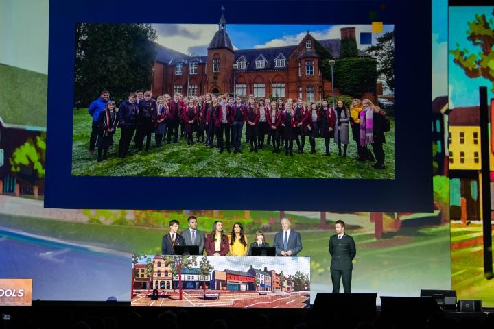
Students from Lurgan College, St. Ronan’s College, and Lurgan Junior High School have presented a ground-breaking cross-community mapping project at the world's largest GIS conference.Each year in San Diego in the United States, Geographic Information Systems giant Esri runs its global Esri International User Conference. The conference brings together users of the firm's digital mapping platform to showcase the incredible work that's being done in the Geographic Information Systems field. The event was attended by over 19,000 geography enthusiasts from 128 countries around the world.
This year students from Lurgan formed the first group to present at the conference from outside the US in the event's entire 39-year history. A group from three schools int eh area showcased their Lurgan Shared Education Project, which brought together Protestant and Catholic schools in the area to explore and catalogue the sectarian divisions in Lurgan.
The project involved students from the three schools visiting locations on both sides of the community divide in Lurgan and recording their perception of safety in each area using Esri's mobile app platform. They then used Esri Ireland’s ArcGIS online mapping platform to analyse the data, highlighting the geographical sectarian divides that still exist in the town and the locations that students from each community feel unsafe in.
The results of this project haqve already borne fruit for Lurgan, as it has given the PSNI and local council hard data to begin addressing problematic areas in the town. The opportunity to work on this project came to Northern Ireland thanks to Esri Ireland, which gave all schools in Northern Ireland completely free access to its mapping software and platform last year and has worked with schools and teachers to provide training and advice on its use as part of the core curriculum.
The Lurgan Shared Education Project was chosen out of thousands of other school projects from countries around the world to be demonstrated because it's a rare example of using mapping technology to promote peace. The conference is attended by people in every walk of life, from educators and scientists to world-renowned conservationists and global business leaders. This year's speakers also included Jane Goodall, E.O. Wilson, and Esri founder Jack Dangermond.
Alistair Hamill, head of geography, Lurgan College, said: "It is an incredible honour to have been chosen by Esri to travel to the US and present in front of such an engaged and global audience. The students are an inspiration and this has been a life-changing experience for them. As well as presenting at this prestigious event, through the project they have increased their understanding of their town and each other - forming lifelong bonds with new friends. They have also shown the power of collaboration and demonstrated the possibility of a more peaceful and inclusive future."
Source: Written based on press release
About the author
Brendan is a Sync NI writer with a special interest in the gaming sector, programming, emerging technology, and physics. To connect with Brendan, feel free to send him an email or follow him on Twitter.
Got a news-related tip you’d like to see covered on Sync NI? Email the editorial team for our consideration.
Sign up now for a FREE weekly newsletter showcasing the latest news, jobs and events in NI’s tech sector.